Project
QGIS Plugin for Acoustic Consulting


Overview
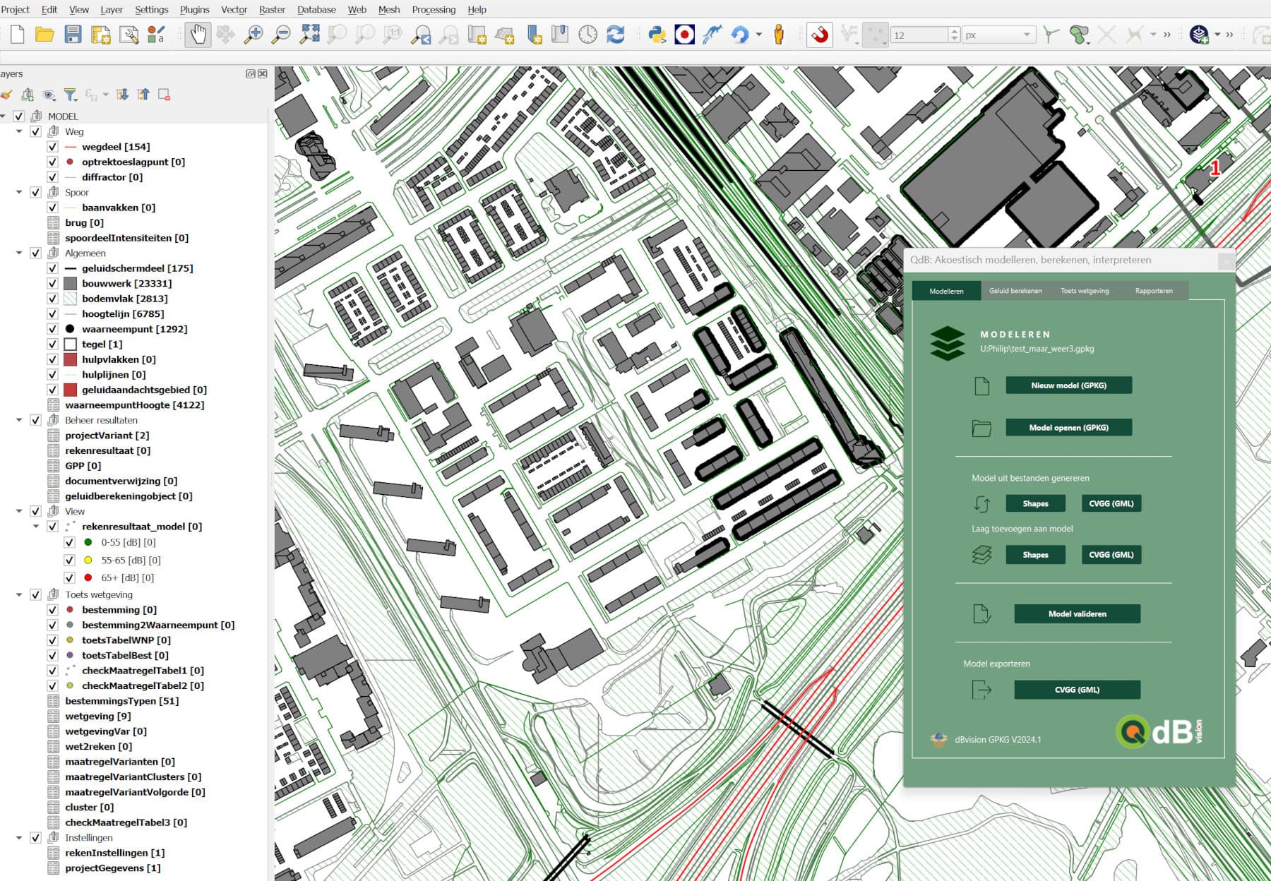
QGIS Plugin for Acoustic Modeling & Analysis (dBvision)
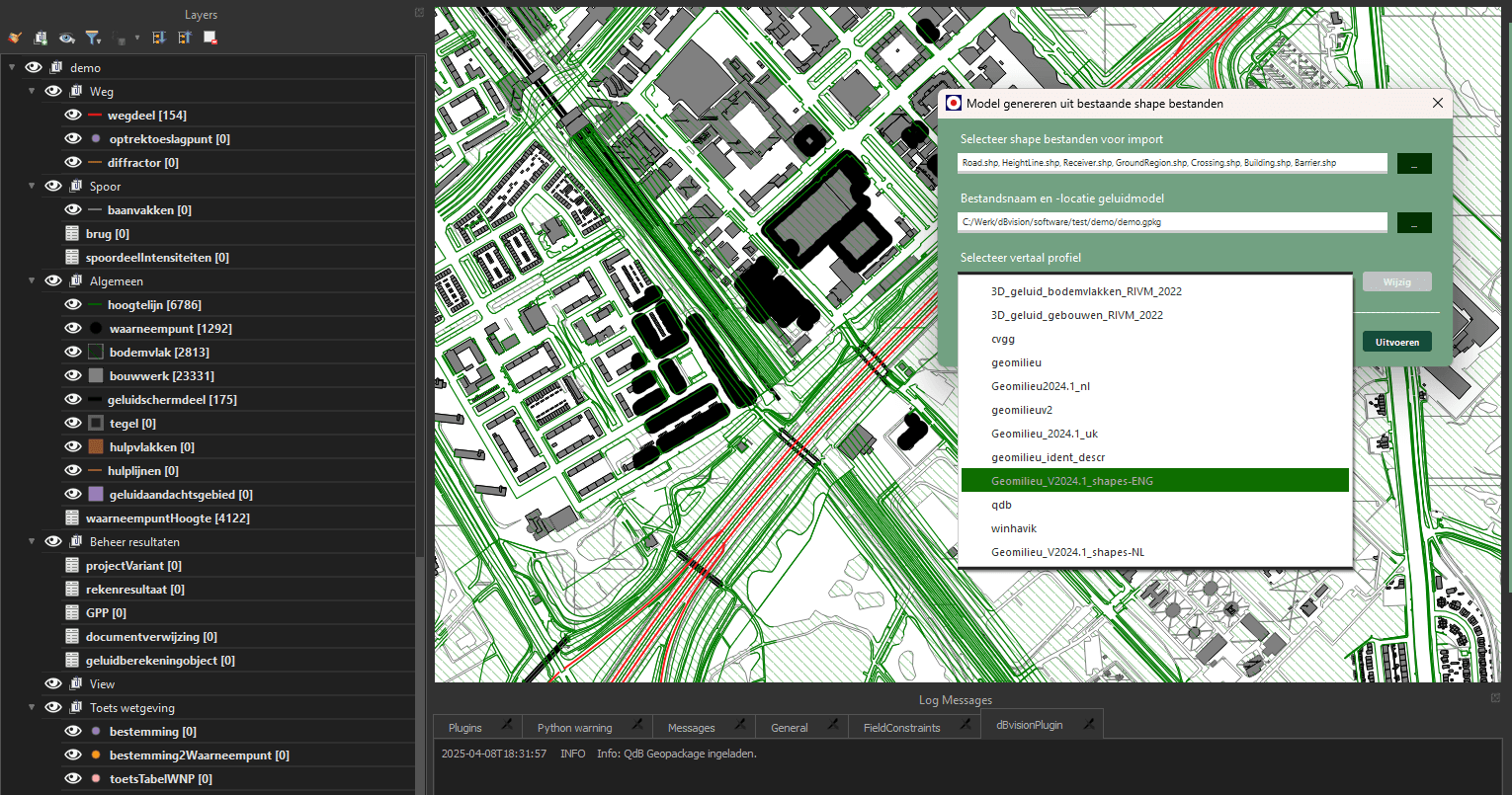
Developed and maintained the “QdB” QGIS plugin and an associated Python package (dBvisionPackage) for dBvision. This project established a comprehensive geospatial data pipeline tailored for acoustic consultants, streamlining their workflow for noise modeling, analysis, and compliance with Dutch environmental regulations (SWUNG/WMB) using the RIVM “Rekenhart Geluid” calculation engine.
Key Contributions & Technical Features
Geospatial Data Engineering & ETL Pipeline
- Designed and implemented a specialized GeoPackage-based data model (“dBvisionDM”) optimized for acoustic features, using
sqlite3andosgeo.ogr(GDAL). - Engineered robust ETL (Extract, Transform, Load) processes within
dBvisionPackageto ingest data from diverse sources (Shapefiles, GML, Geomilieu, CVGG, WinHavik). - Developed complex data transformations using JSON-defined profiles for schema mapping, coded value translation, and unit conversions between external standards and the internal model.
- Ensured data integrity by programmatically creating and enforcing the data model structure (tables, fields, data types, constraints, spatial reference systems such as EPSG:28992) within the GeoPackage.
- Focused on efficient data handling within the pipeline, balancing processing speed with data integrity, considering optimizations for large datasets (e.g., exploring efficient libraries like PyArrow for future scalability).
Advanced Geospatial Processing & Analysis
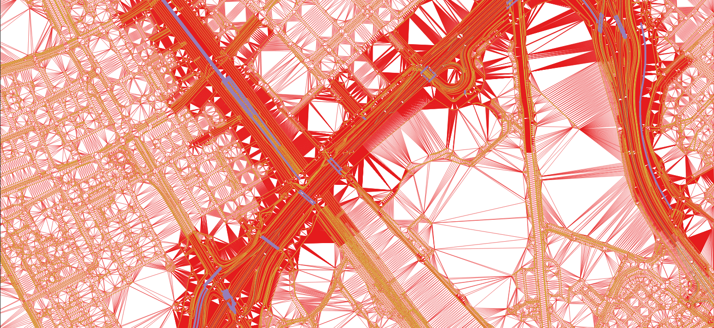
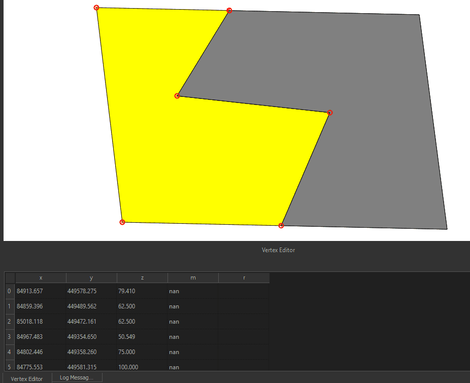
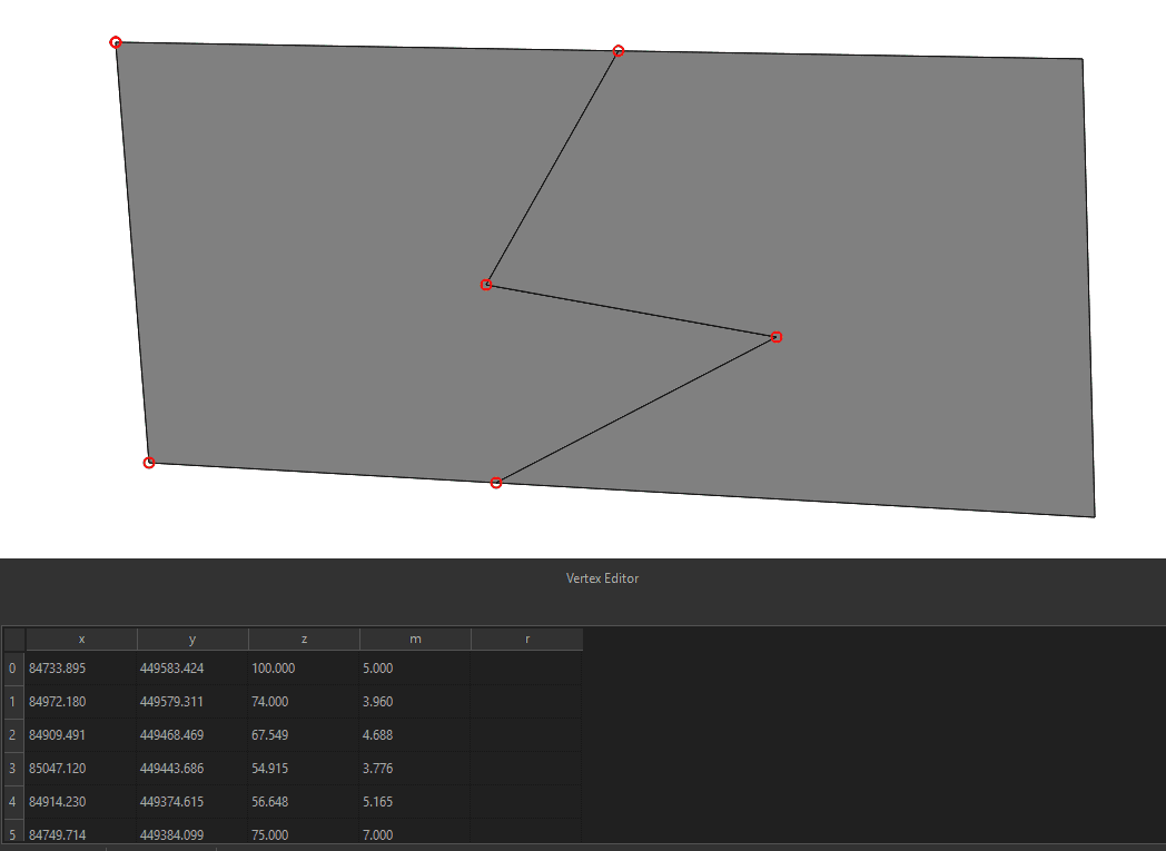
- Developed a custom QGIS geometry splitting tool (“Intersector”) using PyQt, Shapely, and direct GDAL/SQL. This tool addressed native QGIS limitations by preserving and accurately interpolating Z (height) and M (measure) values during the splitting of LineStringZM/PolygonZM features, crucial for 3D/4D acoustic data fidelity.
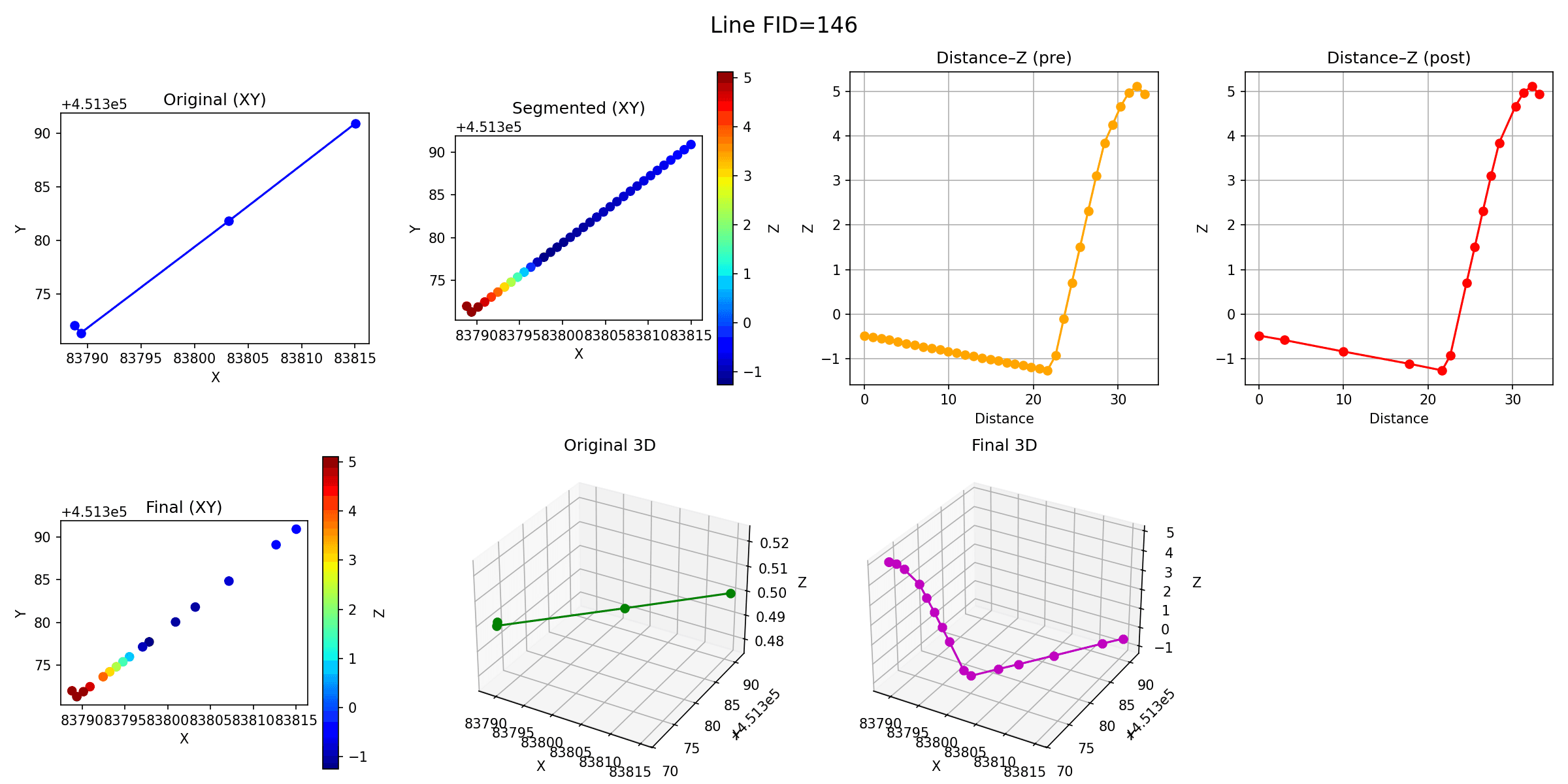
- Implemented height-interpolation algorithms (“dBvisionPackage.hoogteInterpolatie”) using spatial analysis techniques to enrich 2D datasets with elevation (Z) values from reference height maps.
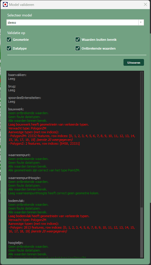
- Integrated data validation checks (“CheckDialog”) to verify model consistency and adherence to standards before calculation, ensuring reliable analysis inputs.
Custom geometry splitting tool (Z/M preserving)


Height interpolation

Data validation
Automation, Integration & Reporting
- Orchestrated the end-to-end workflow within the QGIS plugin, managing the data pipeline from ingestion and validation to calculation preparation.
- Automated the interaction with the external “Rekenhart” calculation engine (data submission, results retrieval).
- Integrated SWUNG standard functionalities for results analysis: scenario comparison, mitigation assessment, cumulative calculations, and compliance checks against Dutch environmental laws (Wet milieubeheer).
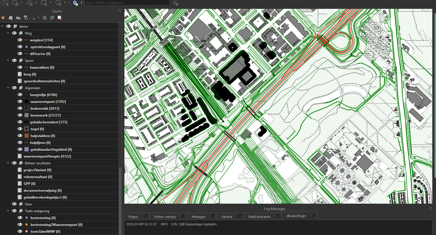
- Enabled generation of standardized PDF reports and visualization of model data and results as QGIS layers.
Technical Stack
Languages & libraries: Python, SQL
Geospatial: QGIS API/PyQt, osgeo/GDAL, Shapely, GeoPackage, SQLite (SpatiaLite)
Data handling: Pandas, NumPy (with considerations for libraries like PyArrow for performance)
Environment: QGIS plugin development
This project highlights significant data engineering challenges within the geospatial domain, including designing complex ETL pipelines, ensuring data integrity across systems, performing advanced spatial analysis, balancing efficiency and scalability, and developing custom tooling to overcome platform limitations for 3D/4D data processing.
Stack
- Python
- QGIS
- GDAL
- GeoPandas
- SQL
- GPKG (SQLite)
- Shapely